WildCAT

Crane Radar Hackathon

The Crane Radar

The Crane Radar is a predictive map that gives birdwatchers a real-time indication of where and when crane birds can be spotted and the direction they are heading.

March of this year, Wageningen University (WUR) and Sensing Clues tested the first online version. Based on observations made by citizen scientists via the platform Waarneming.nl, flocks of cranes appeared on the map. An animation then showed the likely location of these flocks, based on the most recent observations, over 20 years of historic observations, and knowledge about for example their average flying speed.

Challenges

To improve the predictions, the hackathon was aimed at finding ways to incorporate additional environmental factors, such as local weather conditions. In addition we wanted to crack several technical issues of the web application, to allow as many bird enthusiasts as possible to use the crane radar during the upcoming autumn migration.

Results

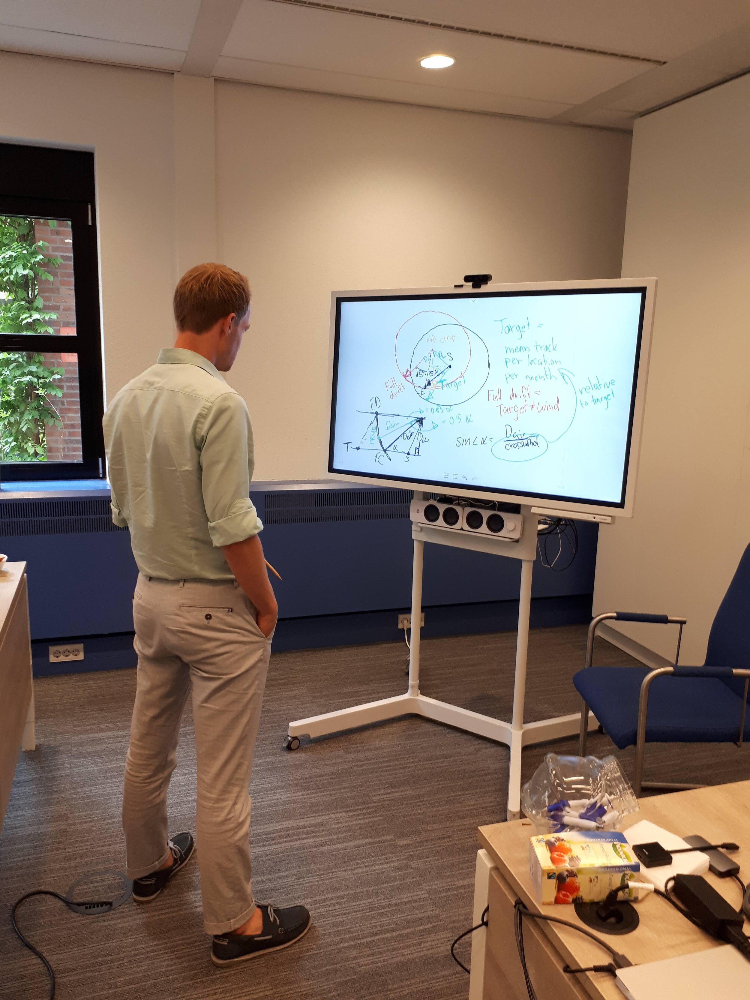
Based on GPS data provided by the Swedish University of Agricultural Sciences, we were not only able to confirm that wind speed and direction significantly impact the speed and direction of cranes. We also cracked the mathematics behind drift and compensation, two important factors for improving our predictions.

What’s next

In the upcoming months the WUR and Sensing Clues are refining the models and preparing the website. We’ll bring it live in September, about a month before the actual migration starts.

Keep an eye out for our new and improved Crane Radar!

Webinar: Using computer vision to keep track of animals in the wild

Webinar: Using computer vision to keep track of animals in the wild

On 29 October Jan Kees Schakel will join Mike Kraus of Vantage AI for the webinar ‘Using computer vision to keep track of animals in the wild’ to show how our Solution Partner Vantage AI helped us to develop an image recognition solution.

Camera trapping for wildlife insights

Camera trapping for wildlife insights

Last year we announced Vantage AI as our newest Solution Partner, and we are proud to announce our first close collaboration: creating an algorithm that is able to detect species from different regions across the globe that are captured by a camera trap.

Vantage AI strengthens Sensing Clues Wildlife Intelligence

Vantage AI joins the Sensing Clues alliance!

In close collaboration with Sensing Clues and its partners, data scientists of Vantage AI will work on challenging projects ranging from computer vision to advanced spatial analytics, to further develop the Sensing Clues Wildlife Insights tool suite.

DataLab for Wildlife Protection

screen-shot-2017-08-14-at-11-56-57-e1502707528970.png

More species are being threatened with extinction than ever before. To protect them we need to bring together and boost our strengths!

In regular life we use technologies to tackle all kinds of problems. So should we when it comes to the protection of wildlife.

To accelerate data-driven innovation, Sensing Clues, together with Nieuwegein CityDIKW Intelligence and Bluemine, set up the Nieuwegein Datalab (NGDL).

The DataLab is a meeting space and hands-on laboratory for everyone interested in Data Science, Internet of Things (IoT) and Artificial Intelligence. A space to experiment, to develop and challenge new ideas.

Working together with professionals, scientists, and students, Sensing Clues uses the DataLab as incubator for data driven solutions for the protection of wildlife.

Curious? Below are two of the projects we are working on:

  • Sound Event Recognition for Vigilance and Localisation (SERVAL)

  • Wildlife Crime Analyst Toolbox (WildCAT)

Want to join one of our projects or to start a data-driven wildlife protection project of your own? Just drop us a note to start your expedition!