
sensing clues
We help nature conservation professionals with data-driven solutions to protect, manage and nurture nature. Our team consists of ecologists, law enforcement professionals, data scientists and ICT engineers dedicated to (co-) creating solutions to assess the state of wellbeing of protected nature areas, the pressures and threats they endure, and the location and timing for (preventive) action.
SUPPORTED FUNCTIONS
Core Subjects
-
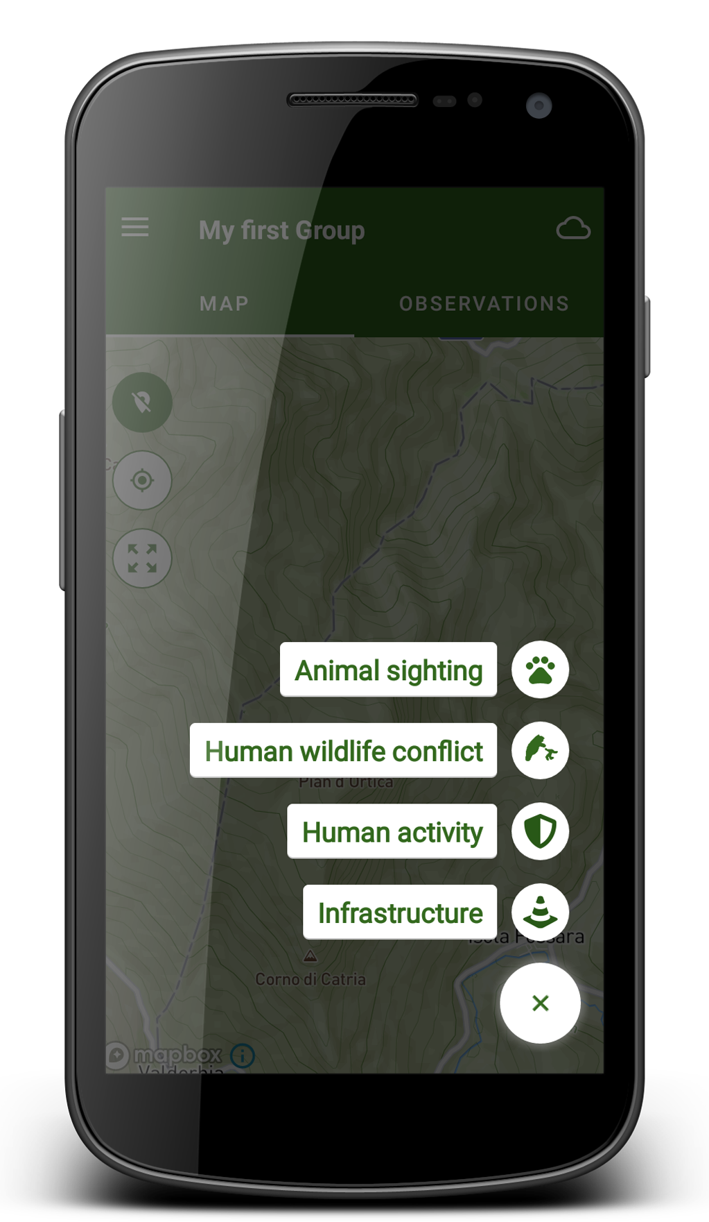
Data-driven nature conservation starts with recording sightings, events, and tracks.
These ‘observations’ and tracks are recorded by agents, which could be rangers, biologists, or citizen scientists, but also camera-traps, sensors, or animal trackers.
To complete the picture, we enrich the information with open source data, such as open street maps and satellite-based information.
-
Monitoring is all about detecting meaningful change. Our ambition is to detect these changes as early (and easy) as possible, to enable proactive action, before it is too late.
-
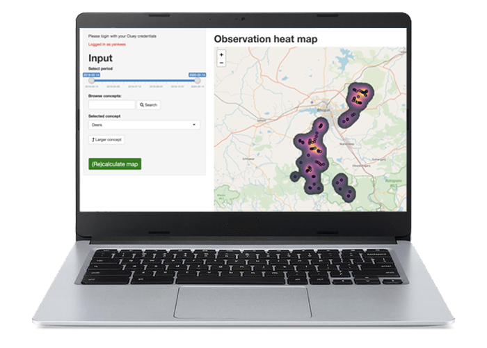
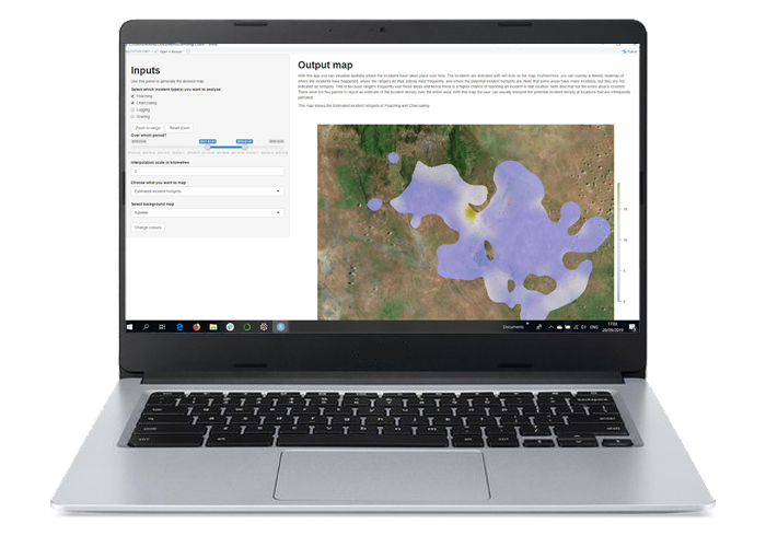
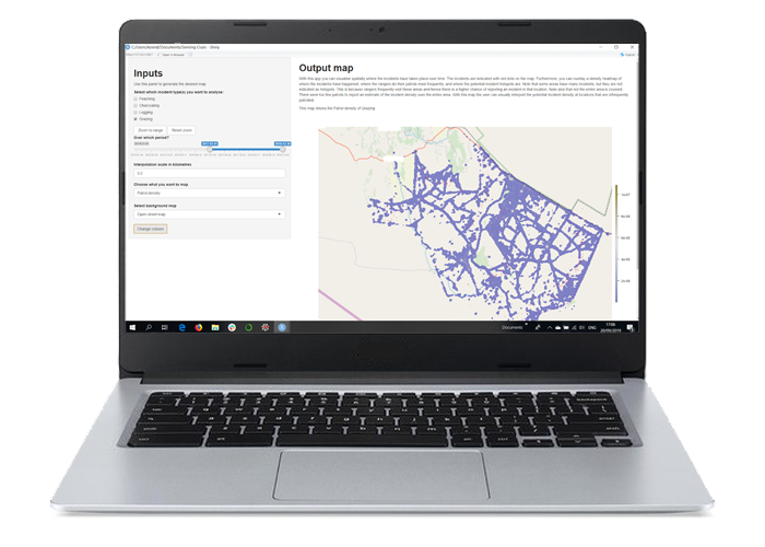
Our analytical apps help you to learn where and when risks such as illegal logging, charcoaling and poaching, are bound to happen.
We distinguish between periodic risk maps, which highlight risk areas for the next 30 days, and radars, which predict risks in the next few hours.
-
A simple yet powerful reporting engine helps you to produce insightful bar charts and maps for decision makers.
-
When you’ve got connected animal trackers or other types of sensors, you can (quite easily) create alerting rules. For example:
an animal is not moving (dead?)
an animal is nearing a crop field (alert QRTs)
The water level drops below a certain level (check pump)
A licence plate matches a whitelist (friends, don’t worry).
-
Assessing biodiversity and monitoring meaningful change in space over time, is at the core of almost every nature conservation organisation.
To this end, we’re developing powerful methods and tools to monitor
habitats,
fauna,
and pressures
-
Every day, thousands of rangers, guardians, wardens, scouts, and volunteers are in the field to protect wildlife and enforce the law.
To support them, we’ve developed a ‘full information cycle’ in which the information they are collecting is enriched and fed back to them to the form of thematic risk maps.
-
Where (potentially dangerous) animals roam into human dominated landscapes, measures have to be put in place to protect both humans and animals.
To this end we are investing in Early Warning and Action Networks (EWAN), which help protectors to take just-in-time measures.
-
In many areas, community-led nature conservation is key to long-lasting success. Almost all NGOs we are working with organise activities aimed at awareness creation, alternative livelihoods, sustainable farming practices, health, eduction, and more.
In support of these activities, we’ve developed special Community Work modules to record these activities and to create statistical overviews, needed to assess impact.
-
Every area has POIs that require time-to-time attention. Such as for example special trees, boreholes, entry gates, sign posts, camera-traps, ranger stations, caves, and more.
Within the Sensing Clues platform you can maintain custom lists of these POIs, which enables you to systematically monitor them.

Why Sensing Clues
-
Watch our Youtube-tutorials (1 to 3 minutes each)
Download the Cluey Data Collector from the Google Playstore
Create your user account (it’s free ! )
Configure the data model, by de-selecting what you do not need
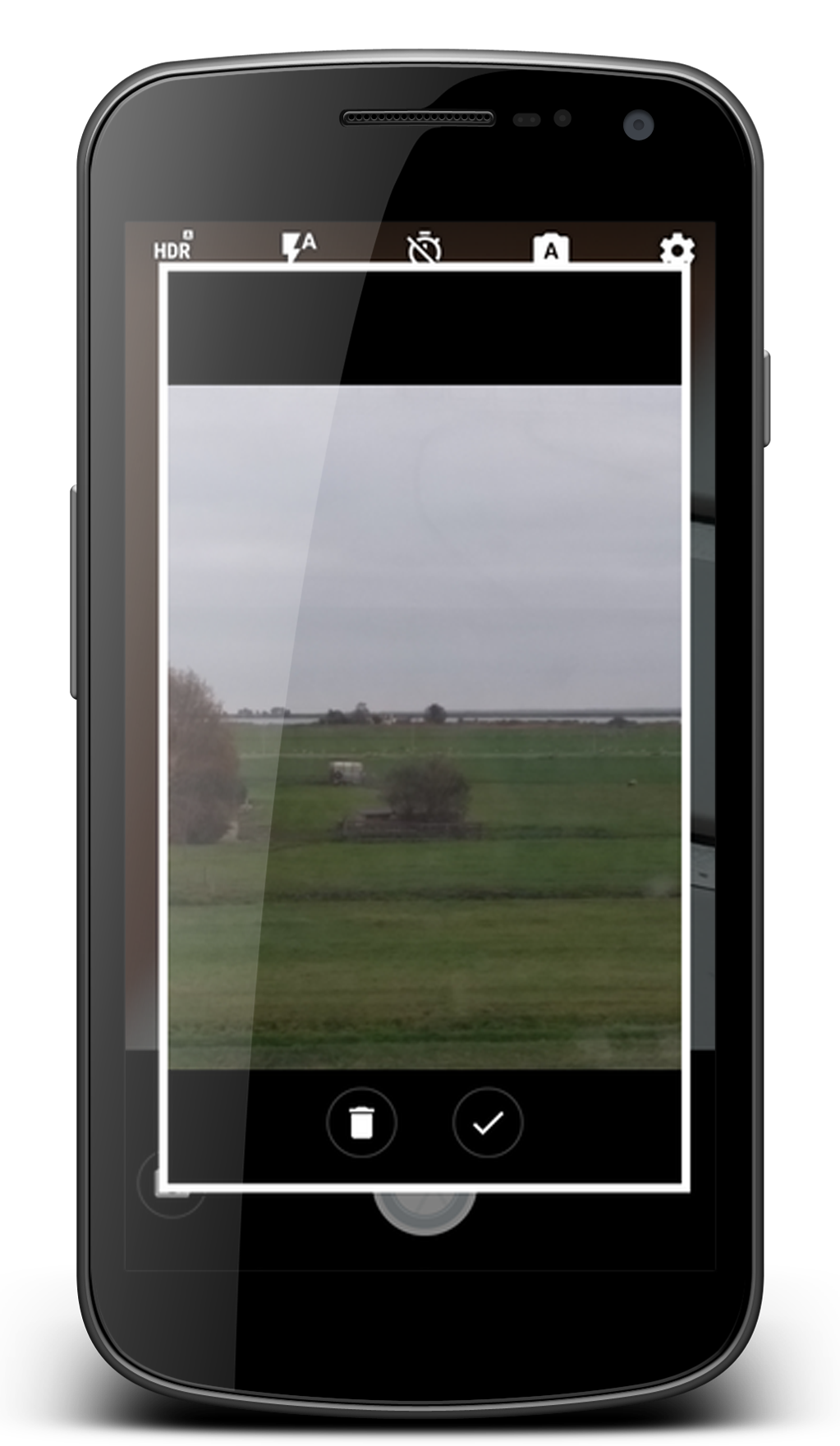
Record your first observation!
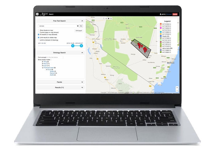
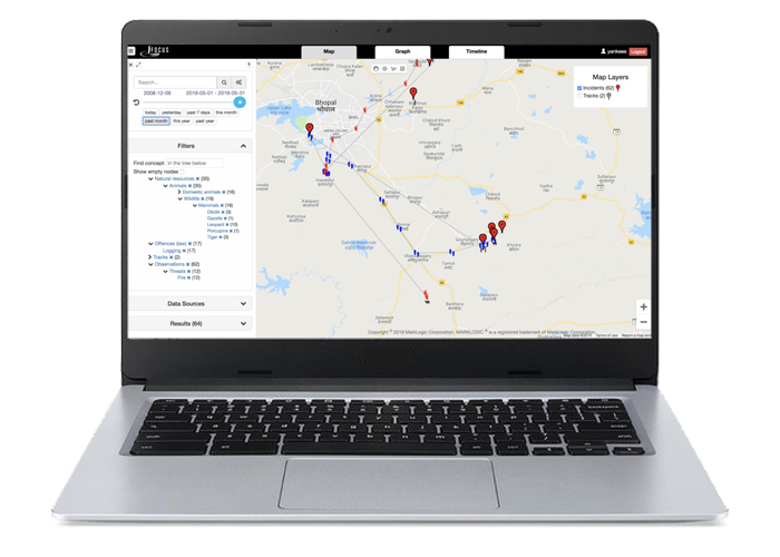
Review your recordings (and those of your friends) in Focus
Create maps or charts to create overview and gain deeper understanding
Any help need? Contact us!
-
The Sensing Clues platform has a unique and innovative data model, which supports the storage and processing of any type of data. All collected data and connected data sources can be analysed as if it is just one data source. This makes it extremely easy for anyone to answer questions which in other platforms require expert skills or even the programming of dedicated queries.
-
Continuous learning requires feedback on past action. We’re working on functions to close this information cycle. We do so by using recorded field observations to create (and update) advanced risk maps, that field officers can use to make to make their operations more efficient and effective.
-
Free help is available through our online helpdesk.
An optional annual subscription fee gives you
a direct whatsapp-line with one of our customer success officers
access to a set of specialist tools
8 hours of support to help you to get most out of our tool suite
access to our weekly Data Science Sessions, where you get help to develop your own analytical projects
inclusion of missing items and custom lists (fair use)
-
The Sensing Clues platform is paid for by our Solution Partners, and thus free for any NGO engaged in nature conservation or wildlife protection.
But even free tools come at a cost. Such as training costs, cloud hosting costs, configuration, maintenance and upgrading costs, etc.
The Sensing Clues platform is designed to minimise training costs and avoid reliance on (expensive) experts. Moreover, our cloud-hosting costs are sponsored, too.
If you’ve got programming skills and want to use our platform to build your own analytical models, reports or maps, you can do so. With or without our help. This, too, gives you options to further reduce costs.
These measures combined make Sensing Clues the most affordable platform for nature conservation in the market.
-
We’ve taken 3 measures to give you full control over your own data, and to allow integration with any third party:
You can export all data that you’ve collected. You can do so at any time and without our help
We maintain open RESTful APIs
Native Python and R-libraries to develop your own reports or maps on top of our platform